Perilfinder™

Instant property-level hazard insights, real-time accumulation visibility, and easy collaboration tools, helping underwriters, portfolio managers, and risk managers reduce friction, cut decision time, and gain confidence in their view of risk.

Why Perilfinder™

Location-level intelligence you can trust, across insurance, finance, and real estate.

Powered by KatRisk’s multi-peril data, Perilfinder™ delivers building level peril risk information, real-time accumulation views, and customizable reporting and analytics all in one platform.
01

Speed & Efficiency

  • Rooftop-accurate geocoding in seconds
  • Instant risk indicators (red, amber, green) by peril risk scoring based on your rules
  • Drag-and-drop book-of-business uploads for rapid evaluation


02

Smarter Insights

  • Real-time accumulation and exposure views
  • Multi-peril coverage in a single platform: flood, SCS, tropical cyclone wind, and more
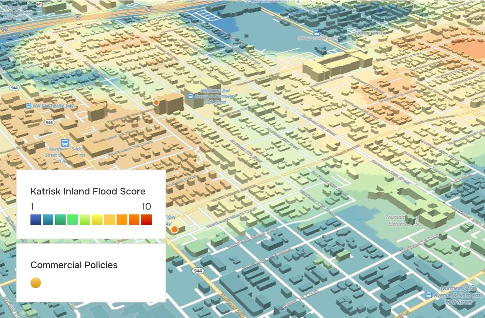
  • Advanced 3D visualizations that make risk immediately clear


03

Seamless Collaboration

  • One-click reporting with polished PDFs
  • Easy sharing and clean audit trails for faster team decisions


04

Flexible Integration

  • Cloud-native architecture: fast, scalable, always available
  • API-first design for direct integration into your underwriting workflows
  • Customizable with your own data layers and business rules


05

Unmatched Customer Service

  • Backed by KatRisk’s client success team, known for responsive support and collaborative partnerships
  • From onboarding to ongoing training, we act as an extension of your team to ensure long-term value


Tailored to Your Workflow

Perilfinder is delivered as two customizable platforms, Perilfinder Insights for address-level risk intelligence and Perilfinder Portfolio for portfolio management.


Perilfinder Insights

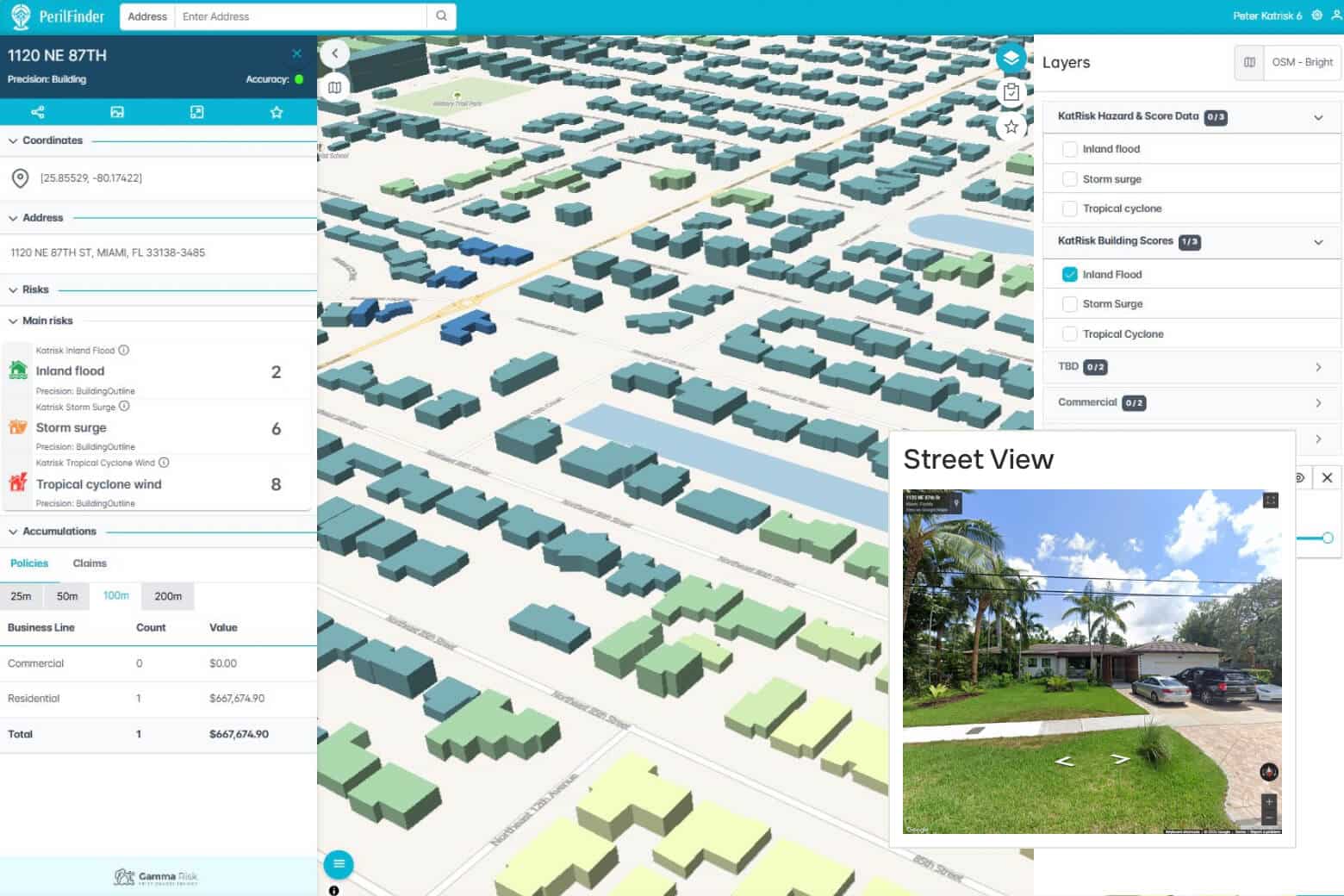
Risk intelligence at the property-level. Through rooftop-accurate geocoding interface, users can search by address, map, or coordinates to retrieve all available risk information.
01

Custom Risk Scoring

Apply your own business rules to get clear Red-Amber-Green outputs for multiple hazards.

02

Rich Data Feeds

Access attributes, spatial layers, aerial imagery, and StreetView™.

03

Advanced Checks

Run accumulation views, historic event overlays, and moratorium checks.

04

Financial Precision

For deeper analysis, connect to KatRisk’s proven financial models for outputs like AAL and beyond.

05

Customizable Data Layers

Access robust built-in hazard data, with the option to integrate additional partner datasets at your request.
Perilfinder Portfolio

Powerful portfolio analysis and management tools for teams managing books of business.
01

Portfolio Integration

Upload and manage policies directly in the platform.

02

Interactive Mapping

Visualize accumulations, filter by risk values or spatial proximity, and analyze third-party data alongside your own.

03

Customizable Views

Tailor dashboards and layers to your business needs for a comprehensive risk perspective.

04

Future-Ready

Portfolio is the first release in the Perilfinder range, with upcoming modules for event analysis, dashboard reporting, portfolio optimization, AI, and more.

Features

Rapid address-level risk assessment

Rooftop-accurate scoring available instantly at point of sale or during portfolio analysis.

Dynamic geospatial risk visualizations

Smooth, intuitive mapping that makes hazard and accumulation insights immediately clear.

One-click uploads in seconds

Drag-and-drop a full book of business for lightning-fast evaluation and repricing.

API-first integration

Streamlined web services make Perilfinder’s data and scoring easy to plug into your existing workflows.

Inside Perilfinder

From first quote to portfolio roll-up, Perilfinder is designed to remove friction, reduce errors, and help you move faster without losing precision.

Geocoding Engine

  • Rooftop accuracy across the U.S., UK and Ireland.
  • Seamless integration with Precisely, AutoAddress and third-party tools


Risk Scoring and Accumulation

  • Real-time RAG scoring tailored to your rules
  • Interactive accumulation analysis with custom thresholds


Reporting and Claims Support

  • Instant PDF downloads for every property
  • Post-event analysis made simple


Flexible Deployment

  • Web app and/or API
  • Hosted on AWS


Access and deployment

an API hosted service described by a cloud with four wires

AWS-Hosted

Hosted on AWS.

Web App and/or API

Access via web app and/or API.

Related products and services

Access models with unparalleled reliability

Speak to our team to see how SpatialKat can help you assess catastrophe risk with more confidence.