Catastrophe models are powerful tools that are used within the financial services industry to quantify the economic effects of natural catastrophes on both a local and national scale. In addition to being able to model potential losses in the current climate, catastrophe models are also uniquely situated to model the economic loss impacts created by global climate change. Their ability to quantify changes in hazard and loss using climate model output provides valuable insight into the financial impacts of climate change beyond that provided by climate models alone.
Catastrophe models have been used in the re/insurance industry for nearly 30 years to underwrite, price, and transfer risk. Now, adjacent industries within the financial and governmental spheres such as mortgage and real estate, city planning, and more are also beginning to adopt these modeling solutions due to their ability to describe the economic impact of natural catastrophes. We believe that the speed of adoption of catastrophe models, particularly as it pertains to quantifying the changing risk due to climate change, must accelerate if we are to address challenges such as the unpriced storm surge risk in the mortgage industry, which will adversely affect the underlying value of homes in a given neighborhood. Additionally, organizations can use analytics from catastrophe models to support financial institutions in understanding evolving SEC rules that require disclosure of climate impacts created by companies. This has already begun in the UK to address the new climate change disclosures required by the Bank of England.
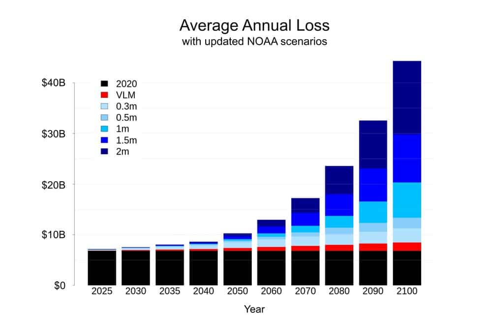
While catastrophe models can be used as a tool to manage and understand climate risk, in order to adequately and accurately do so, the models must be updated regularly and rapidly with new climate models and data that reflect the latest science available. The ability to quickly incorporate the latest climate science and provide these new insights to clients is a foundational principle of how KatRisk operates. As an illustrative example, KatRisk has recently incorporated the latest NOAA climate projections, which were released February 15, 2022, into its SpatialKat product so that clients can already use these to frame their risk. The chart below shows average annual loss (AAL) considering a sample US economic exposure for years between 2025 and 2100 using the latest NOAA scenarios implemented in the SpatialKat hurricane storm surge model. The AAL for each year is broken down to show the contribution to loss from vertical land motion (VLM) and a range of modeled global mean sea level (GMSL) rise values in 2100 ranging from 0.3 meters to 2 meters.
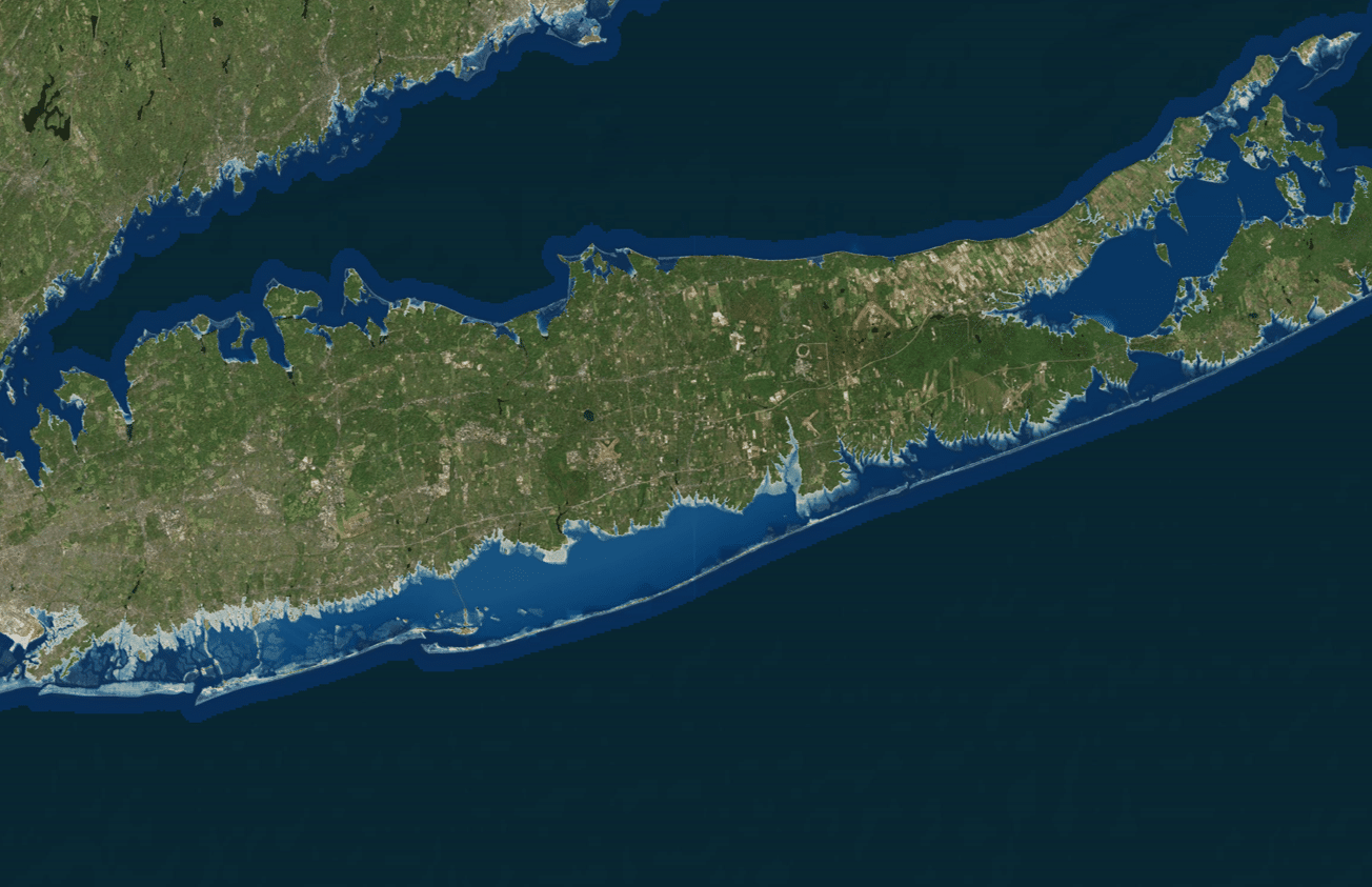
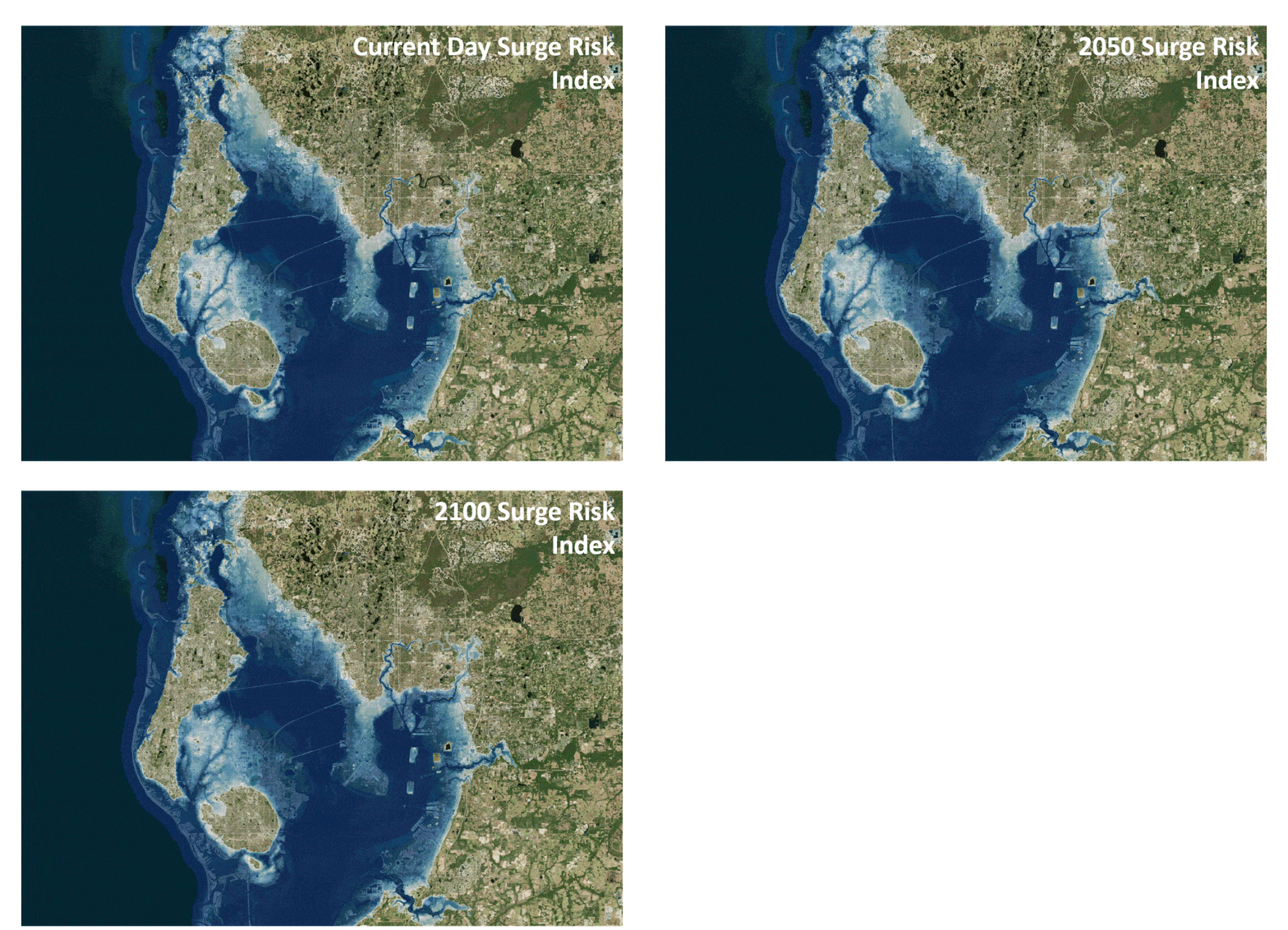
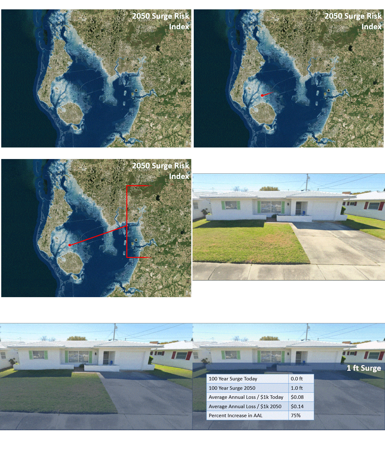
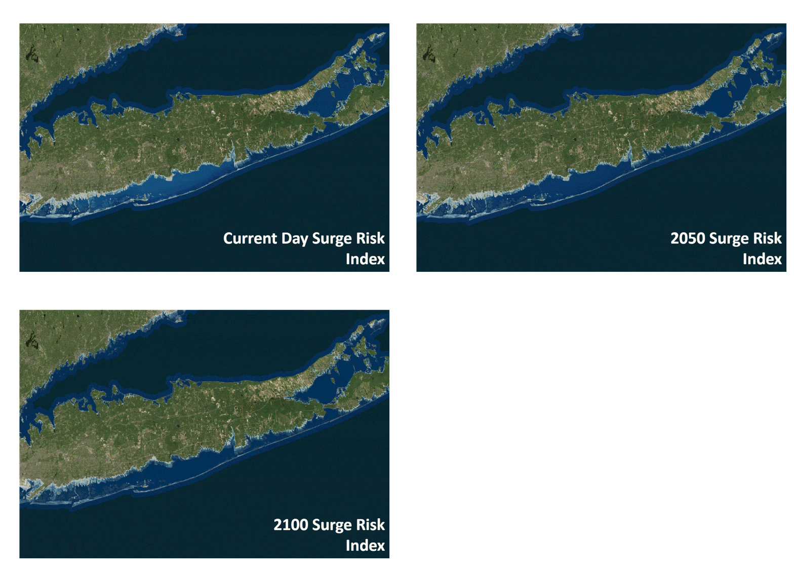
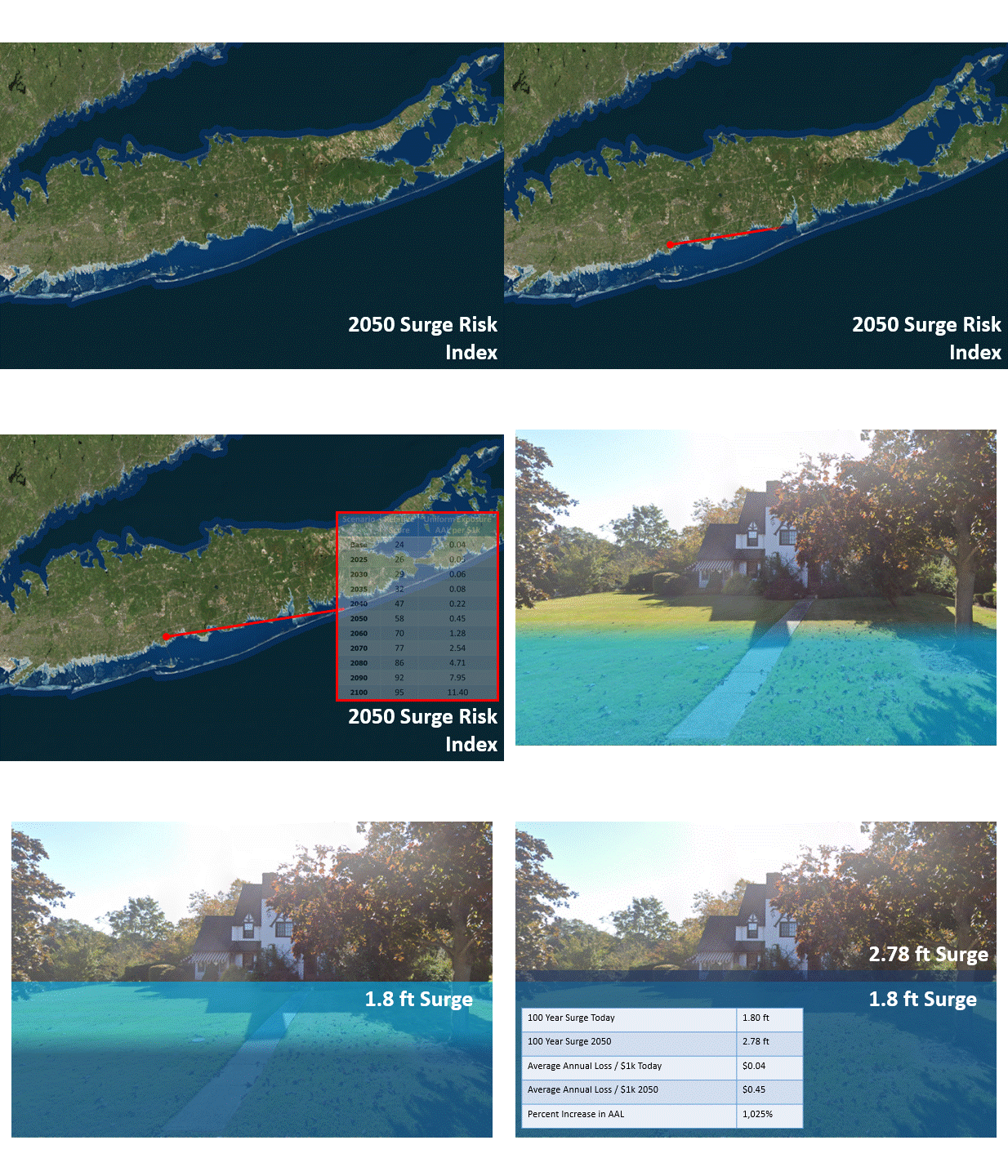
More tangibly, insurers and beyond can use KatRisk data to explore the impacts on specific areas and locations. The below series of images shows how the KatRisk modeling suite can be leveraged to both qualify and quantify changes to storm surge risk as a result of climate change-induced global sea-level rise at the property level. Examples are shown for Tampa, Florida, where people often think about storm surge, and Long Island, New York, where communities will see increased impact due to climate change which may not be expected. Relative risk scores along with changes in average annual expected loss to a theoretical property are provided for storm surge risk in steps of 10 years along with an image depicting what the changes in 100-year return period surge heights could look like for a property.
Tampa, Florida
Long Island, New York
To learn more about how KatRisk uses climate data in its catastrophe models and rapidly deploys these updates to customers, please reach out to us at contact@katrisk.com or see us at RAA 2022.
